Advanced Aerial Inspections for Accurate Property Assessments
At Premis Chartered Surveyors, we utilise drone technology to conduct high-quality aerial surveys, providing a safe, efficient, and detailed way to inspect properties and hard-to-reach areas. Our RICS-qualified surveyors use drones to capture high-resolution images and video footage, ensuring a thorough assessment of your property’s condition.
Why Use a Drone Survey?
Traditional property inspections can be limited when it comes to high roofs, chimneys, or inaccessible areas. A drone survey allows us to:
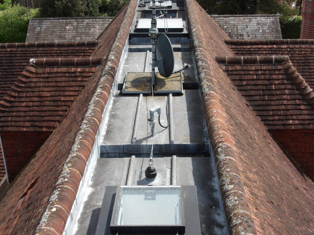
Assess Roofs & Chimneys
Identify defects such as missing tiles, structural weaknesses, or weather damage without the need for scaffolding or ladders.
Inspect Large or Complex Buildings
Ideal for surveying larger properties, period homes, or buildings with intricate roof structures.
Enhance Survey Reports
Aerial imagery provides a clear visual record, supporting our professional reports with precise photographic evidence.
Improve Safety & Efficiency
Reduces the risks associated with traditional high-level inspections while providing rapid results.
When Should You Consider a Drone Survey?
A drone survey is particularly useful for:
Pre-Purchase Inspections
Ensuring the roof and upper structures of a property are in good condition before buying.
Building Surveys (RICS Level 3)
Complementing our detailed structural assessments with aerial footage.
Damage Assessments
Identifying storm damage, leaks, or other defects affecting the upper parts of a building.
Historic & Listed Buildings
Providing a non-intrusive method of inspection for delicate or protected structures.
Professional & Licensed Drone Operators
Our drone surveys are conducted by fully qualified and insured professionals who comply with all Civil Aviation Authority (CAA) regulations. We ensure that all flights are carried out legally and safely, providing high-quality data for our reports.
Book a Drone Survey
If you need a safe, accurate, and professional aerial property inspection, contact Premis Chartered Surveyors today to discuss how a drone survey can help you.